 |
|||
|
|
|||
|
Page Title:
Figure 1-2. Indirect fire plotting board M17. |
|
||
| ||||||||||
|
|
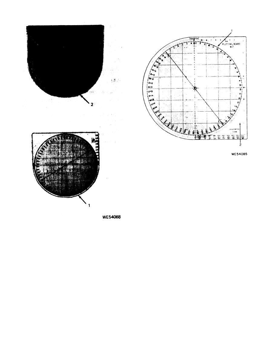 Figure 1-2. Indirect fire plotting board M17.
1 centimeter each. The first division, to the right
of the index line is equally divided into 10 spaces
of 1 millimeter each. The nine graduation lines
in the first division and all figures in the middle
scale are red.
( e ) The grid pattern (7) is inclosed
within an 8.000-inch circle. A series of l-inch
v e r t i c a l and horizontal squares and parts of
squares are located within the circle parallel
to the index and O. P. (observation post) lines
(2). Each complete l-inch square is divided into
Figure 1-1. Indirect fire plotting board M17 W/E.
100 equal squares. Twenty-eight incomplete 1-
inch squares, bordering on the circle, contain
of the base is graduated into 20 equal spaces.
varying amounts of smaller squares and parts of
The central graduation line of the scale is di-
squares. There are 78 equally spaced vertical
rectly above the centrally located index mark
and horizontal lines and 80 equal vertical and
(4). Ten equal divisions of the scale are located
horizontal squares along the index and O.P. lines.
to each side of the index mark. The vernier scale
All marking is red.
marking is red.
(f) The index line, passing through the
(d) At the bottom of the base (6) is a
center of the grid pattern, has an arrow touch-
triple map scale (5) graduated in meters with
ing the top inside diameter of the circle. The ar-
its legend and representative ratios of 1:50,000,
row points to the O (zero) index mark. A thin
1:25,000, and 1:5,000. These representative ra-
line, from the point of the arrow, intersects the
tios refer respectively to the top, middle, and
index mark and extends to, and becomes the cen-
lower scales. These scales are used to transfer
terline of, the vernier scale. This thin line is the
data to or from a map or firing chart which has
point on the plotting board base at which all
one of these scales. The triple map scale is 1
deflections are read. The index line is graduated
decimeter long and is divided into 10 divisions of
1-2
|
|
Privacy Statement - Press Release - Copyright Information. - Contact Us |
